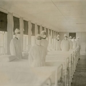
Spatial comparison of London’s three waves of Spanish Flu

Submitted: 7 August 2023
Accepted: 4 October 2023
Published: 19 October 2023
Accepted: 4 October 2023
Abstract Views: 881
PDF: 410
HTML: 197
HTML: 197
Publisher's note
All claims expressed in this article are solely those of the authors and do not necessarily represent those of their affiliated organizations, or those of the publisher, the editors and the reviewers. Any product that may be evaluated in this article or claim that may be made by its manufacturer is not guaranteed or endorsed by the publisher.
All claims expressed in this article are solely those of the authors and do not necessarily represent those of their affiliated organizations, or those of the publisher, the editors and the reviewers. Any product that may be evaluated in this article or claim that may be made by its manufacturer is not guaranteed or endorsed by the publisher.
Similar Articles
- Amare Sewnet Minale, Kalkidan Alemu, Mapping malaria risk using geographic information systems and remote sensing: The case of Bahir Dar City, Ethiopia , Geospatial Health: Vol. 13 No. 1 (2018)
- Kristin Meseck, Marta M. Jankowska, Jasper Schipperijn, Loki Natarajan, Suneeta Godbole, Jordan Carlson, Michelle Takemoto, Katie Crist, Jacqueline Kerr, Is missing geographic positioning system data in accelerometry studies a problem, and is imputation the solution? , Geospatial Health: Vol. 11 No. 2 (2016)
- Ernesto Pascotto, Diego Capraro, Paolo Tomè, Mauro Spanghero, Topographic distribution of gastritis in heavy pigs investigated by a geographic information system approach , Geospatial Health: Vol. 11 No. 2 (2016)
- Nicola Ferrè, Werner Kuhn, Massimo Rumor, Stefano Marangon, A conceptual holding model for veterinary applications , Geospatial Health: Vol. 8 No. 2 (2014)
- Tobias Törnros, Helen Dorn, Markus Reichert, Ulrich Ebner-Priemer, Hans-Joachim Salize, Heike Tost, Andreas Meyer-Lindenberg, Alexander Zipf, A comparison of temporal and location-based sampling strategies for global positioning system-triggered electronic diaries , Geospatial Health: Vol. 11 No. 3 (2016)
- Nicola Ferrè, Paolo Mulatti, Matteo Mazzucato, Monica Lorenzetto, Matteo Trolese, Dario Pandolfo, Piero Vio, Guido Sitta, Stefano Marangon, GeoCREV: veterinary geographical information system and the development of a practical sub-national spatial data infrastructure , Geospatial Health: Vol. 5 No. 2 (2011)
- Sumiko Anno, Keiji Imaoka, Takeo Tadono, Tamotsu Igarashi, Subramaniam Sivaganesh, Selvam Kannathasan, Vaithehi Kumaran, Sinnathamby Noble Surendran, Space-time clustering characteristics of dengue based on ecological, socio-economic and demographic factors in northern Sri Lanka , Geospatial Health: Vol. 10 No. 2 (2015)
- Ricardo Ramìrez-Aldana , Juan Carlos Gomez-Verjan, Omar Yaxmehen Bello-Chavolla , Lizbeth Naranjo, A spatio-temporal study of state-wide case-fatality risks during the first wave of the COVID-19 pandemic in Mexico , Geospatial Health: Vol. 17 No. s1 (2022): Special issue on COVID-19
- Mokhalad A. Majeed, Helmi Z. M. Shafri, Aimrun Wayayok, Zed Zulkafli, Prediction of dengue cases using the attention-based long short-term memory (LSTM) approach , Geospatial Health: Vol. 18 No. 1 (2023)
- Matthew Richard McGrail, John Stirling Humphreys, Spatial access disparities to primary health care in rural and remote Australia , Geospatial Health: Vol. 10 No. 2 (2015)
<< < 3 4 5 6 7 8 9 10 11 12 > >>
You may also start an advanced similarity search for this article.

 https://doi.org/10.4081/gh.2023.1235


