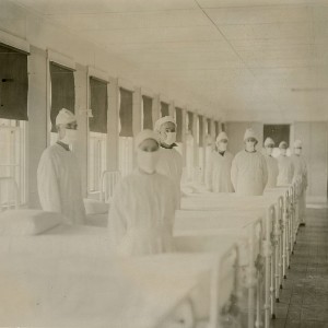
Spatial comparison of London’s three waves of Spanish Flu

Submitted: 7 August 2023
Accepted: 4 October 2023
Published: 19 October 2023
Accepted: 4 October 2023
Abstract Views: 881
PDF: 410
HTML: 197
HTML: 197
Publisher's note
All claims expressed in this article are solely those of the authors and do not necessarily represent those of their affiliated organizations, or those of the publisher, the editors and the reviewers. Any product that may be evaluated in this article or claim that may be made by its manufacturer is not guaranteed or endorsed by the publisher.
All claims expressed in this article are solely those of the authors and do not necessarily represent those of their affiliated organizations, or those of the publisher, the editors and the reviewers. Any product that may be evaluated in this article or claim that may be made by its manufacturer is not guaranteed or endorsed by the publisher.
Similar Articles
- Muhammad Nur Aidi, Fitrah Ernawati, Efriwati Efriwati, Nunung Nurjanah, Rika Rachmawati, Elisa Diana Julianti, Dian Sundari, Fifi Retiaty, Anwar Fitrianto, Khalilah Nurfadilah, Aya Yuriestia Arifin, Spatial distribution and identifying biochemical factors affecting haemoglobin levels among women of reproductive age for each province in Indonesia: A geospatial analysis , Geospatial Health: Vol. 17 No. 2 (2022)
- A. Desiree LaBeaud, Ann-Marie Gorman, Joe Koonce, Christopher Kippes, John McLeod, Joe Lynch, Timothy Gallagher, Charles H. King, Anna M. Mandalakas, Rapid GIS-based profiling of West Nile virus transmission: defining environmental factors associated with an urbansuburban outbreak in Northeast Ohio, USA , Geospatial Health: Vol. 2 No. 2 (2008)
- David E. Koch, Rhett L. Mohler, Douglas G. Goodin, Stratifying land use/land cover for spatial analysis of disease ecology and risk: an example using object-based classification techniques , Geospatial Health: Vol. 2 No. 1 (2007)
- David Taylor, Michael Hagenlocher, Anne E. Jones, Stefan Kienberger, Joseph Leedale, Andrew P. Morse, Environmental change and Rift Valley fever in eastern Africa: projecting beyond HEALTHY FUTURES , Geospatial Health: Vol. 11 No. s1 (2016): HEALTHY FUTURES
- Agustin Estrada-Peña, José M. Venzal, A GIS framework for the assessment of tick impact on human health in a changing climate , Geospatial Health: Vol. 1 No. 2 (2007)
- Edmund Y.W. Seto, Freyja Knapp, Bo Zhong, Changhong Yang, The use of a vest equipped with a global positioning system to assess water-contact patterns associated with schistosomiasis , Geospatial Health: Vol. 1 No. 2 (2007)
- Ajib Diptyanusa, Lutfan Lazuardi, Retnadi Heru Jatmiko, Implementation of geographical information systems for the study of diseases caused by vector-borne arboviruses in Southeast Asia: A review based on the publication record , Geospatial Health: Vol. 15 No. 1 (2020)
- Fabienne Marechal, Nathalie Ribeiro, Murielle Lafaye, Antonio Güell, Satellite imaging and vector-borne diseases: the approach of the French National Space Agency (CNES) , Geospatial Health: Vol. 3 No. 1 (2008)
- Sibylle Sturtz, Katja Ickstadt, A descriptive and model-based spatial comparison of the standardised mortality ratio and the age-standardised mortality rate , Geospatial Health: Vol. 1 No. 2 (2007)
- Robert Bergquist, Laura Rinaldi, Covid-19: Pandemonium in our time , Geospatial Health: Vol. 15 No. 1 (2020)
<< < 35 36 37 38 39 40 41 42 43 44 > >>
You may also start an advanced similarity search for this article.

 https://doi.org/10.4081/gh.2023.1235


