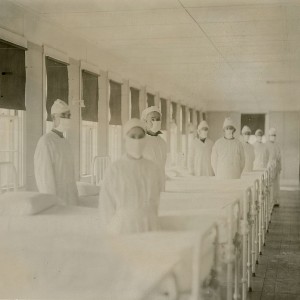
Spatial comparison of London’s three waves of Spanish Flu

Submitted: 7 August 2023
Accepted: 4 October 2023
Published: 19 October 2023
Accepted: 4 October 2023
Abstract Views: 881
PDF: 410
HTML: 197
HTML: 197
Publisher's note
All claims expressed in this article are solely those of the authors and do not necessarily represent those of their affiliated organizations, or those of the publisher, the editors and the reviewers. Any product that may be evaluated in this article or claim that may be made by its manufacturer is not guaranteed or endorsed by the publisher.
All claims expressed in this article are solely those of the authors and do not necessarily represent those of their affiliated organizations, or those of the publisher, the editors and the reviewers. Any product that may be evaluated in this article or claim that may be made by its manufacturer is not guaranteed or endorsed by the publisher.
Similar Articles
- Marcos César Ferreira, Spatial association between the incidence rate of COVID-19 and poverty in the São Paulo municipality, Brazil , Geospatial Health: Vol. 15 No. 2 (2020)
- Rodrigo Augusto Ferreira de Souza, Rita Valéria Andreoli, Mary Toshie Kayano, Afrânio Lima Carvalho, American cutaneous leishmaniasis cases in the metropolitan region of Manaus, Brazil: association with climate variables over time , Geospatial Health: Vol. 10 No. 1 (2015)
- Luciana Casartelli-Alves, Maria Regina Reis Amendoeira, Viviane Cardoso Boechat, Luiz Cláudio Ferreira, João Carlos Araujo Carreira, José Leonardo Nicolau, Eloiza Paula de Freitas Trindade, Julia Novaes de Barros Peixoto, Mônica de Avelar Figueiredo Mafra Magalhães, Raquel de Vasconcellos Carvalhaes de Oliveira, Tânia Maria Pacheco Schubach, Rodrigo Caldas Menezes, Mapping of the environmental contamination of Toxoplasma gondii by georeferencing isolates from chickens in an endemic area in Southeast Rio de Janeiro State, Brazil , Geospatial Health: Vol. 10 No. 1 (2015)
- Tamotsu Igarashi, Akihiko Kuze, Shinichi Sobue, Aya Yamamoto, Kazuhide Yamamoto, Kei Oyoshi, Keiji Imaoka, Toru Fukuda, Japan's efforts to promote global health using satellite remote sensing data from the Japan Aerospace Exploration Agency for prediction of infectious diseases and air quality , Geospatial Health: Vol. 8 No. 3 (2014)
- Alexander Liss, Magaly Koch, Elena N. Naumova, Redefining climate regions in the United States of America using satellite remote sensing and machine learning for public health applications , Geospatial Health: Vol. 8 No. 3 (2014)
- Alok Tiwari, Mohammed Aljoufie, A qualitative geographical information system interpretation of mobility and COVID-19 pandemic intersection in Uttar Pradesh, India , Geospatial Health: Vol. 16 No. 1 (2021)
- Fazlay S. Faruque, Hui Li, Worth B. Williams, Lance A. Waller, Bruce T. Brackin, Lei Zhang, Kim A. Grimes, Richard W. Finley, GeoMedStat: an integrated spatial surveillance system to track air pollution and associated healthcare events , Geospatial Health: Vol. 8 No. 3 (2014)
- Uriel Kitron, Julie A. Clennon, M. Carla Cecere, Ricardo E. Gürtler, Charles H. King, Gonzalo Vazquez-Prokopec, Upscale or downscale: applications of fine scale remotely sensed data to Chagas disease in Argentina and schistosomiasis in Kenya , Geospatial Health: Vol. 1 No. 1 (2006)
- Peter M. Macharia, Paul O. Ouma, Ezekiel G. Gogo, Robert W. Snow, Abdisalan M. Noor, Spatial accessibility to basic public health services in South Sudan , Geospatial Health: Vol. 12 No. 1 (2017)
- Verônica Santos Barbosa, Ricardo José de Paula Souza e Guimarães, Rodrigo Moraes Loyo, Constança Simões Barbosa, Modelling of the distribution of Biomphalaria glabrata and Biomphalaria straminea in the metropolitan region of Recife, Pernambuco, Brazil , Geospatial Health: Vol. 11 No. 3 (2016)
<< < 33 34 35 36 37 38 39 40 41 42 > >>
You may also start an advanced similarity search for this article.

 https://doi.org/10.4081/gh.2023.1235


