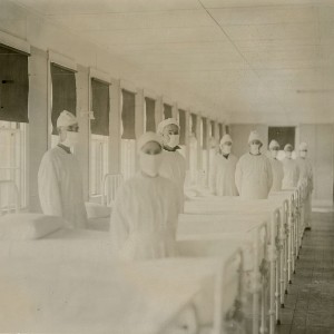
Spatial comparison of London’s three waves of Spanish Flu

Submitted: 7 August 2023
Accepted: 4 October 2023
Published: 19 October 2023
Accepted: 4 October 2023
Abstract Views: 881
PDF: 410
HTML: 197
HTML: 197
Publisher's note
All claims expressed in this article are solely those of the authors and do not necessarily represent those of their affiliated organizations, or those of the publisher, the editors and the reviewers. Any product that may be evaluated in this article or claim that may be made by its manufacturer is not guaranteed or endorsed by the publisher.
All claims expressed in this article are solely those of the authors and do not necessarily represent those of their affiliated organizations, or those of the publisher, the editors and the reviewers. Any product that may be evaluated in this article or claim that may be made by its manufacturer is not guaranteed or endorsed by the publisher.
Similar Articles
- Jerry Enoe , Michael Sutherland, Dexter Davis, Bheshem Ramlal, Charisse Griffith-Charles , Keston H. Bhola, Elsai Mati Asefa, A conceptional model integrating geographic information systems (GIS) and social media data for disease exposure assessment , Geospatial Health: Vol. 19 No. 1 (2024)
- Michael T. Gebreslasie, A review of spatial technologies with applications for malaria transmission modelling and control in Africa , Geospatial Health: Vol. 10 No. 2 (2015)
- Laura Grisotto, Dario Consonni, Lorenzo Cecconi, Dolores Catelan, Corrado Lagazio, Pier Alberto Bertazzi, Michela Baccini, Annibale Biggeri, Geostatistical integration and uncertainty in pollutant concentration surface under preferential sampling , Geospatial Health: Vol. 11 No. 1 (2016): Valencia Issue
- Susanna Tora, Silvio Sacchini, Eddy Listeš, Tanja Bogdanović, Alessio Di Lorenzo, Muhamed Smajlović, Ahmed Smajlović, Jelena V. Filipović, Vildana Tahirović, Danijela Å uković, Bojan Beljkas, Ardian Xinxo, Renis Maçi, Patrizia Colangeli, Federica Di Giacinto, Annamaria Conte, A geographical information system for the management of the aquaculture data in the Adriatic Sea - the Strengthening of Centres for Aquaculture Production and Safety surveillance in the Adriatic countries experience: Present capabilities, tools and functions , Geospatial Health: Vol. 12 No. 2 (2017)
- Lorenzo Cecconi, Annibale Biggeri, Laura Grisotto, Veronica Berrocal, Laura Rinaldi, Vincenzo Musella, Giuseppe Cringoli, Dolores Catelan, Preferential sampling in veterinary parasitological surveillance , Geospatial Health: Vol. 11 No. 1 (2016): Valencia Issue
- Tawanda Manyangadze, Moses John Chimbari, Michael Gebreslasie, Samson Mukaratirwa, Application of geo-spatial technology in schistosomiasis modelling in Africa: a review , Geospatial Health: Vol. 10 No. 2 (2015)
- Jishuo Zhang, Meifang Li, Spatial access to public hospitals during COVID-19 in Nottinghamshire, UK , Geospatial Health: Vol. 17 No. 2 (2022)
- Vicente Y. Belizario, John Paul Caesar R. delos Trinos, Berne Silawan, Chiqui M. De Veyra, Agapito Hornido, Hansel Amoguis, Dominic Basalo, Cherry Dema-ala, Irenn Mantilla, Rosele Layan, The use of geographic information system as a tool for schistosomiasis surveillance in the province of Davao del Norte, the Philippines , Geospatial Health: Vol. 12 No. 2 (2017)
- Dohyeong Kim, Yingyuan Zhang, Chang Kil Lee, Understanding needs and barriers to using geospatial tools for public health policymaking in China , Geospatial Health: Vol. 13 No. 1 (2018)
- Sirak Zenebe Gebreab, Danielle Vienneau, Christian Feigenwinter, Hampâté Bâ, Guéladio Cissé, Ming-Yi Tsai, Spatial air pollution modelling for a West-African town , Geospatial Health: Vol. 10 No. 2 (2015)
<< < 1 2 3 4 5 6 7 8 9 10 > >>
You may also start an advanced similarity search for this article.

 https://doi.org/10.4081/gh.2023.1235


