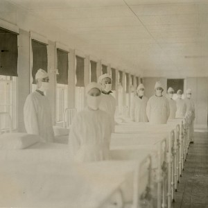
Spatial comparison of London’s three waves of Spanish Flu

Submitted: 7 August 2023
Accepted: 4 October 2023
Published: 19 October 2023
Accepted: 4 October 2023
Abstract Views: 882
PDF: 410
HTML: 198
HTML: 198
Publisher's note
All claims expressed in this article are solely those of the authors and do not necessarily represent those of their affiliated organizations, or those of the publisher, the editors and the reviewers. Any product that may be evaluated in this article or claim that may be made by its manufacturer is not guaranteed or endorsed by the publisher.
All claims expressed in this article are solely those of the authors and do not necessarily represent those of their affiliated organizations, or those of the publisher, the editors and the reviewers. Any product that may be evaluated in this article or claim that may be made by its manufacturer is not guaranteed or endorsed by the publisher.
Similar Articles
- Giuliano Cecchi, Albert Ilemobade, Yvon Le Brun, Lenny Hogerwerf, Jan Slingenbergh, Agro-ecological features of the introduction and spread of the highly pathogenic avian influenza (HPAI) H5N1 in northern Nigeria , Geospatial Health: Vol. 3 No. 1 (2008)
- Laura Rinaldi, Vincenzo Musella, Vincenzo Veneziano, Renato U. Condoleo, Giuseppe Cringoli, Helmintic infections in water buffaloes on Italian farms: a spatial analysis , Geospatial Health: Vol. 3 No. 2 (2009)
- Lena Fiebig, Timo Smieszek, Jennifer Saurina, Jan Hattendorf, Jakob Zinsstag, Contacts between poultry farms, their spatial dimension and their relevance for avian influenza preparedness , Geospatial Health: Vol. 4 No. 1 (2009)
- Rebecca Click Lambert, Korine N. Kolivras, Lynn M. Resler, Carlyle C. Brewster, Sally L. Paulson, The potential for emergence of Chagas disease in the United States , Geospatial Health: Vol. 2 No. 2 (2008)
- Laura Rinaldi, Guy Hendrickx, Giuseppe Cringoli, Annibale Biggeri, Els Ducheyne, Dolores Catelan, Eric Morgan, Diana Williams, Johannes Charlier, Georg von Samson-Himmelstjerna, Jozef Vercruysse, Mapping and modelling helminth infections in ruminants in Europe: experience from GLOWORM , Geospatial Health: Vol. 9 No. 2 (2015): GLOWORM Special Issue
- Iain J. East, Samuel Hamilton, Graeme Garner, Identifying areas of Australia at risk of H5N1 avian influenza infection from exposure to migratory birds: a spatial analysis , Geospatial Health: Vol. 2 No. 2 (2008)
- Zhijie Zhang, Dongmei Chen, Michael P. Ward, Qingwu Jiang, Transmissibility of the highly pathogenic avian influenza virus, subtype H5N1 in domestic poultry: a spatio-temporal estimation at the global scale , Geospatial Health: Vol. 7 No. 1 (2012)
- Sanjaya Kumar, Ming Liu, Syni-An Hwang, A multifaceted comparison of ArcGIS and MapMarker for automated geocoding , Geospatial Health: Vol. 7 No. 1 (2012)
- Muhammad Shahzad Sarfraz, Nagesh K. Tripathi, Fazlay S. Faruque, Usama Ijaz Bajwa, Asanobu Kitamoto, Marc Souris, Mapping urban and peri-urban breeding habitats of Aedes mosquitoes using a fuzzy analytical hierarchical process based on climatic and physical parameters , Geospatial Health: Vol. 8 No. 3 (2014)
- Iain J. East, Samuel A. Hamilton, Louise A. Sharp, Michael G. Garner, Identifying areas of Australia at risk for H5N1 avian influenza infection from exposure to nomadic waterfowl moving throughout the Australo-Papuan region , Geospatial Health: Vol. 3 No. 1 (2008)
<< < 14 15 16 17 18 19 20 21 22 23 > >>
You may also start an advanced similarity search for this article.

 https://doi.org/10.4081/gh.2023.1235


